
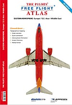
Printed atlas
Atlas Eastern Hemisphere
Europe, the Middle East, South-East Asia and South Africa — over 4,500 airports on topographical charts you can fold into a flight bag.
Secure checkout handled by PayPal — pay by PayPal balance, bank or card. Shipping address collected at checkout.
The Pilots Atlas Eastern Hemisphere covers Europe, the Middle East, South-East Asia and South Africa on topographical charts featuring over 4,500 airports.
Each chart shows waypoints, VOR/DME and NDB navigation aids and Special Use Airspace, together with weather frequencies, points of interest, landmarks and an airport directory with ICAO codes. Railways, rivers and major highways are included for ground reference, while airports are colour-coded by runway length and surface type, and international and regional aerodromes are symbol-coded for quick identification.
A dedicated Captain's Corner section adds aircraft registration tables, VOLMET broadcasts, aerodrome lighting and runway markings, weather symbols, time zones and satellite imagery.
The same trusted cartography is also available in the Pilots Atlas app for iPad and iPhone.
Specifications
- Coverage
- Europe, Middle East, S.E. Asia, South Africa
- Europe
- 92 pages · scale 1:2,000,000
- South-East Asia
- 40 pages · scale 1:4,000,000
- South Africa
- 8 pages · scale 1:2,750,000
- Airports
- 4,500+
- Price
- €29.99 incl. VAT + p&h